Road Surface Quality
Read our RSQ onepagers here:
Find a video describing the RSQ service here:
You are welcome to contact Hermes Traffic Intelligence if you want a demonstation of the service in your area:
Follow the link below to request a quote for Road Surface Quality:
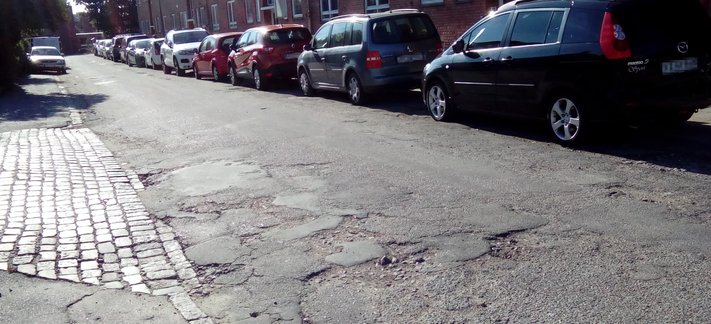
Get a quick overview of the quality of the road surfaces in your municipality or on your road network. With the service Road Surface Quality (or RSQ) available on Hermes Traffic Intelligence's HOTS website, you can get a quick overview of the condition of the road surfaces in your area and quickly decide the areas that require extra attention, e.g. after frost damage or road work.
The quality of the roads
The system works by letting a number of people drive the roads with a mobile phone fixed in the car. When the car is driving on an uneven road or hits holes in the coating, the resulting jolts are captured by sensors in the mobile phone. The measurements are then assembled in the RSQ service where they are processed and presented. From here you can as user of the service see which routes have been measured, as well as what estimated quality the road surfaces have, based on those measurements.
Measure with a smartphone
The measurements can be made with the app trag.me - Speedometer, developed by Hermes Traffic Intelligence. If one or more of your colleagues use the app when driving the roads in your area enough data will soon be collected to give a fair picture of the roads surface quality. Regularly, lots for gifts are drawn among the users of the app. This helps to ensure that it is used on the roads.
Proof-of-concept
If you want a demonstration of the service you and your colleagues can download the app and start collecting measurements on the roads in the area. Contact us to receive a time-limited access to the system to let you see if it makes sense to you to continue using the service.
With the RSQ service you can:
- Repair roads when holes emerge without having to wait for inquiries from the citizens first.
- See where the roads with the worst surfaces are, and maintain them so the roads that have the most affected road users, will be rectified first.
- See the quality of the roads as a layer in your favorite GIS system.
- Make sure the measurements are relatively new, so that you do not plan maintenance based on old data.
- Locate road bumps and make sure they are not mistakenly interpreted as holes in the road.